Historic low temperatures across county
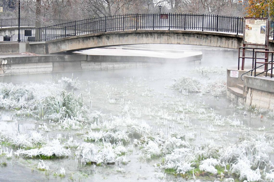
Wind chills in the early hours of Monday morning dipped as low as 2 degrees at the official weather station at the San Marcos Regional Airport. Heading into Wednesday, the lowest temperature recorded during this cold front has been 17 degrees. That was likely broken overnight as temperatures were expected to hit the lowest points yet. The record low of 10 degrees at the San Marcos airport is expected to have been challenged over night and into this morning.
“I think actually [last night] is going to be the coldest night air temperature wise,” Keith White, meteorologist with the National Weather Service Austin-San Antonio, said. “There won’t be as much wind. So wind chill will probably not be as cold as they were [Tuesday morning]. But ambient air temperatures are pretty likely to drop to somewhere between 9 and 14 degrees across the entirety of Hays County.”
A personal weather station in Dripping Springs reported 13 degrees on Tuesday morning and another in Henly reported 14 degrees. Most of the rest in Hays County reported between 15 and 18 degrees as the low.
“Most of our area where we have long term historical records did set record daily lows Tuesday morning, and then also record low daytime highs Monday,” White said. “In fact, up in Austin at Camp Mabry, Monday’s daytime high of 24 was the coldest since 1990, which is rather impressive. In terms of a more general trend of what we’ve seen so far, this is the kind of cold that on average we really only see about once every eight to 10 years, but in our recent memory we’ve had several times just over the last four winters. Obviously, everybody remembers February 2021. [This morning] is likely to be the coldest night since that event. But, you know, we also had that big cold outbreak just before Christmas 2022. That was also rather cold and pretty similar to what we’ve experienced here over the last couple of days.”
The entire cold snap has been record breaking, but it also has also become more common place.
“In the recent past, this kind of cold has happened a little bit more frequently,” White said referencing the now four times it has been this cold or colder since January of 2018. “But on the whole, over the past four decades or so, we went 10 to 15 years without seeing cold like this, so it is a lot for our area.”
The forecast is warming up starting today, but it won’t stay that way for long. Another cold front, though not expected to be quite as significant, is coming quickly.
“We are expecting to finally warm up after last night. It will be the coldest night, but we will likely see temperatures rise above freezing across the entire area by the mid morning hours Wednesday and highs probably in the mid 40s for Wednesday in the San Marcos area. And even warmer still by Thursday could even see us knocking up against 70 degrees for a high on Thursday, which will feel quite balmy after the last few days. But we are then watching for another strong cold front to move through. ... So we’ll be right back to below normal for Friday and the weekend. Probably not as cold as what we just experienced – definitely not during the daytime – but Saturday morning lows could again be right around 20 degrees, which is well below normal for this time of the year. Then it will be shorter lived with this next cold spell. We should only see it stick around for about 36 to 48 hours before we will warm back by the end of the weekend still remaining cooler than normal Friday through the weekend across all of our area though.”
Editor’s Note: This interview was done on Tuesday afternoon. Days referenced in each quote have been change to represent the appropriate day for those reading the paper on Wednesday.


