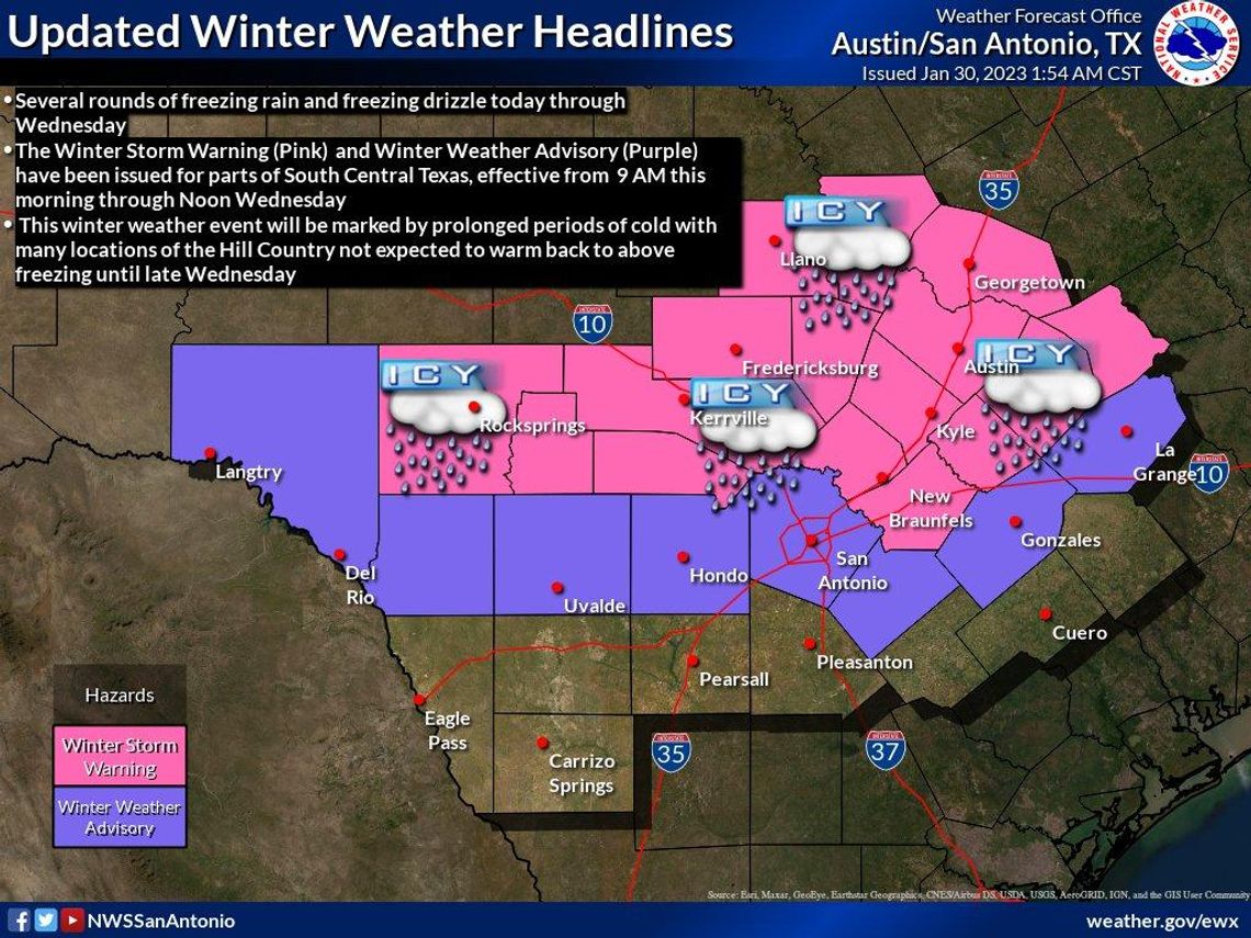
San Marcos is under a Winter Storm Warning as rain and freezing temperatures are in the forecast Tuesday morning.
Winter conditions will linger with rain remaining in the forecast throughout the day and overnight, according to the National Weather Service. Temperatures will be around freezing Tuesday morning before rising to around 36 degrees, according to NWS Meteorologist Brandon Gale. Temperatures will fall again to freezing overnight into Wednesday morning.
The winter storm warning, which went into effect Monday morning, will last until 12 p.m. on Wednesday.
Gale said NWS is expecting two rounds of heavy precipitation.
“The first one will be [Tuesday] morning kind of around sunrise and during the morning commute,” Gale said. “Temperatures at that time in San Marcos will be around 32 degrees. So, that will be the first peak of potential ice accumulation. Then, temperatures throughout the day will rise to 36 [degrees] or so. So, there will be a transition back to just light liquid rain and drizzle. [Tuesday] night into Wednesday, we’ll see a second peak in precipitation and temperatures will also be dropping back to freezing. So, Tuesday night into Wednesday is the second period we’re monitoring. Most of the freezing rain accumulation in Hays County will fall during the second period.”
Gale said there’s a wide range of expected ice accumulation because of the terrain across Hays County.
“Far western parts of Hays County have the higher elevation, we could see up to three-quarters of an inch of ice accumulation through Wednesday,” Gale said. “But closer to the I-35 corridor, we’re looking more at the tenth of an inch to maybe quarter of an inch range.”
Gale recommended residents remain vigilant as the forecast could change throughout the next few days.
“If we’re one degree off on our temperature forecast that could potentially have a decent impact on how much ice accumulation there is,” Gale said. “It’s just a tricky forecast based on the temperatures being right around freezing. People will have to monitor for any potential forecast updates. It will be an evolving forecast.”
NWS warns drivers against driving but suggests keeping an extra flashlight, food and water in the vehicle in case of an emergency.
To see the latest road conditions across the state visit drivetexas.org.


